The C Tow from Gandsfjorden to Vats

The sheer scale of Gullfaks C meant that Gandsfjorden was not deep enough for the subsequent work once the gravity‑base (GBS) substructure’s base section had been completed. Yrkjesfjorden in northern Rogaland, however, offered deep water and sheltered conditions for assignments of this magnitude.
On Monday, 25 May 1987, the tow of Gullfaks C’s 190,000‑tonne base section began. It consisted of the base of the individual cells and the associated skirts—concrete walls continuing the cell structures that would provide penetration and fixity in “soft” seabed conditions with abundant loose sand and clay.
At its widest, the reinforced‑concrete colossus measured 160 metres in diameter. The tow covered a total of 40 nautical miles and the structure had a draft of 32 metres. It arrived the next day, with an average speed of 1.5 knots—essentially a gentle walking pace.[REMOVE]Fotnote: Jølbo, Ove (26 May 1987). “Gullfaks Cruise. The base section arrives in Vats during the afternoon.” In: Stavanger Aftenblad, 26 August 1987,
p. 12.
Towing a structure like this was by no means a straightforward operation—
literally, in the geographic sense.
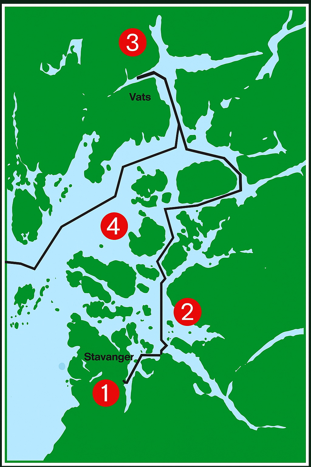
The first leg of the voyage (see point 1 on the map) ran northeast in Gandsfjorden, then east along the north side of the island of Usken, and then north again (2) between Talgje, Fogn and Finnøy. The shortest way onward would have been to continue north between Sjernarøyene and Ombo, but the water there is shallow. So the journey continued around much of Ombo, first along the south side, then
the east side, and then on a northwesterly heading before turning north into Vindafjorden and then west into Yrkjesfjorden to Vats (3).[REMOVE]Fotnote: The map also shows the tow route after the main slipforming and shaft slipforming had been completed in Vats. This tow, with the substructure
already largely finished, proceeded out through Nedstrandfjorden and
Boknafjorden (4) towards Stord for mating of the substructure and the
deck.